
The Name
Before Guatapé was a town with colorful buildings and a granite monolith drawing visitors from Medellín, it was a name. The name belonged to a Tahamí cacique — an indigenous leader of the people who inhabited the eastern Antioquian highlands long before Spanish boots touched this land. The Tahamí dominated a territory of cold rivers, mountain fog, and cultivated slopes. The valley that now fills the Embalse Peñol-Guatapé was their land. The name they gave it — or more precisely, the name their leader carried — is what the town still goes by today.
The Tahamí People
The Tahamí were one of the principal indigenous groups of Antioquia, occupying the mountainous terrain to the east and northeast of what is now Medellín. They were farmers and hunters, adapted to elevation. Their communities were spread across cold-climate valleys where they cultivated corn, potatoes, and other Andean crops alongside rivers that descended from the central cordillera.
They were not a passive people. When the Spanish arrived, the Tahamí resisted. Early expeditions into their territory faced sustained opposition. But resistance had limits against the combined force of Spanish weapons, disease, and the systematic dismantling of indigenous political structures. Over time, the Tahamí were pushed from their ancestral lands, reduced in number, and reorganized under colonial administration.
The Resguardo of 1714
By the early 18th century, the Tahamí who had survived were consolidated into a colonial administrative territory. In 1714, a resguardo — a designated indigenous reserve under Spanish law — was established: San Antonio del Remolino de El Peñol. The name is a mouthful and a layering: Spanish Christian naming on top of the existing geography. This was the formal location where the surviving Tahamí community was placed, where they tried to maintain continuity of culture and territory under conditions imposed by the colonial state.
The resguardo system was protection and constraint simultaneously — it acknowledged indigenous existence while confining and controlling it.
The Town That Grew
From the colonial resguardo, a town took shape. El Peñol grew as a community of mixed indigenous and mestizo settlers over the 18th and 19th centuries. The adjacent settlement that would become Guatapé developed separately, both towns sharing the same valley landscape: the rivers, the mountains, La Piedra — the granite monolith that both municipalities would later dispute.
By the 20th century, El Peñol was an established Antioquian town with a church, a plaza, and a community of several thousand people who had been on this land, in one form or another, for centuries.
The Dam
Between 1970 and 1979, construction and filling of the Peñol-Guatapé hydroelectric project transformed the valley permanently. The project was developed by Empresas Públicas de Medellín (EPM), which still operates it, and it required flooding the Río Nare valley to create one of Colombia’s primary sources of hydroelectric power.
What that meant in practice: large areas of the Río Nare valley were flooded as the reservoir was created, taking valleys, roads, farmland, and the original town of El Peñol underwater. Residents were relocated to a new settlement — the current El Peñol — built on higher ground nearby. They took what they could carry. Houses, crops, cemeteries, the physical infrastructure of community life — all of it went beneath the rising water.
The church steeple of the original El Peñol was the last thing to disappear. When reservoir levels drop low enough, it resurfaces — a cross above the water, marking what is underneath.
The reservoir today: why the water rises and falls
Most visitors call it the lake. It is a reservoir: the Embalse Peñol-Guatapé, created when the Río Nare valley was flooded for hydroelectric power, and still managed for that purpose today. That is why its shoreline can look very different from one visit to the next.
How was the lake in Guatapé formed?
By flooding. Empresas Públicas de Medellín (EPM) developed the Peñol-Guatapé hydroelectric project in stages during the 1970s; the reservoir filled between 1970 and 1979 across the Río Nare valley. Cornare, the regional environmental authority, maps the reservoir’s water surface at about 5,700 hectares in its 2018 management plan for the surrounding protected area; other published figures differ, so treat the size as approximate. The dam holds back the river so the water can drive the Guatapé power plant, one of the largest in Colombia.
Is the Guatapé lake natural?
No. Before the 1970s there was a river valley with farms and the old town of El Peñol. Everything you see as water today is an artificial reservoir. La Piedra, by contrast, is natural and tens of millions of years old.
Why does the reservoir have so many islands?
Because it is a flooded valley, not a basin. The water filled the low ground and left every hilltop standing above it, so former hills became islands and ridges became the peninsulas that give the landscape its shape.
Why is the lake so low sometimes?
The Guatapé reservoir gets low when dry weather reduces the amount of water flowing into it while water is still being released through the hydroelectric system. Because it is an actively managed reservoir, its level can rise and fall much more noticeably than a typical natural lake. Two things are always at work: the rain and rivers that feed it, and the water that leaves through the turbines. When more leaves than arrives, the level drops; when the rains return, it rises again.
Does EPM control the water level?
EPM operates the reservoir and monitors its level, inflows, rainfall, weather forecasts and generation continuously, adjusting gates and turbine operation as conditions change. But the level is not simply set by a switch. It is the balance between what the weather delivers and what the power system uses, within the operating rules the reservoir is managed under.
Does hydroelectric generation lower the reservoir?
Generation is the main way water leaves. In a wet year the inflows replace it and the level holds; in a dry year they do not, and the reservoir falls. Generation on its own does not empty the reservoir, and low inflows on their own do not either. It is the combination.
Does El Niño affect the reservoir?
Yes. El Niño brings drier conditions to this part of Colombia. During the 2024 El Niño period, reservoir levels fell substantially: by April 2024 the Peñol-Guatapé reservoir had seen eleven consecutive months of inflows below the historical average, according to reports citing the national grid operator XM, while electricity demand was rising. Rains later in the year began to refill it. Dry El Niño periods are when visitors see the reservoir at its lowest.
What can you see when the water is low?
More shoreline, muddy or rocky margins, old roads and foundations along the edges, and islands and peninsulas that look larger than usual. Near El Peñol Viejo the church cross and parts of the old town can break the surface. Not every exposed road or wall belongs to the old town; the reservoir covered farms, tracks and houses across the whole valley.
What happened to old El Peñol?
The original town stood in the valley that the reservoir now fills. Its centre was demolished and its people were moved to the new El Peñol built on higher ground; the old town site was flooded in 1978, during the filling of the reservoir. On low-water days its remains reappear, and boat tours from Guatapé pass over the spot.
Did the reservoir create La Piedra?
No. La Piedra is tens of millions of years older than the reservoir. The modern water-and-islands landscape was created only in the twentieth century when the valleys around the already-existing rock were flooded. How the rock itself formed is explained on the La Piedra page.
What Survived
The name survived. Guatapé remained on maps, in official records, in the surnames of families whose roots go back to the Tahamí cacique and his territory. The town rebuilt. The reservoir became an attraction. Visitors came for La Piedra and stayed for the colorful zócalos.
But the history underneath is rarely told at the waterfront restaurants or in the tour operator brochures. The reservoir that makes Guatapé visually striking — the blue water, the hundreds of peninsulas, the landscape that people photograph from the top of La Piedra — is the same reservoir that erased an indigenous-rooted colonial town and displaced its people for the second time in three centuries.
The name Guatapé is a cacique. The water is a dam. The town between them is what remained.
Visiting with This in Mind
None of this makes Guatapé a place to avoid. It makes it a place worth understanding more fully. When you stand at the top of La Piedra and look down at the reservoir, you’re looking at submerged history. When a boat tour passes over the old El Peñol, the guide may point to the church steeple. That’s the most visible part of what the water holds.
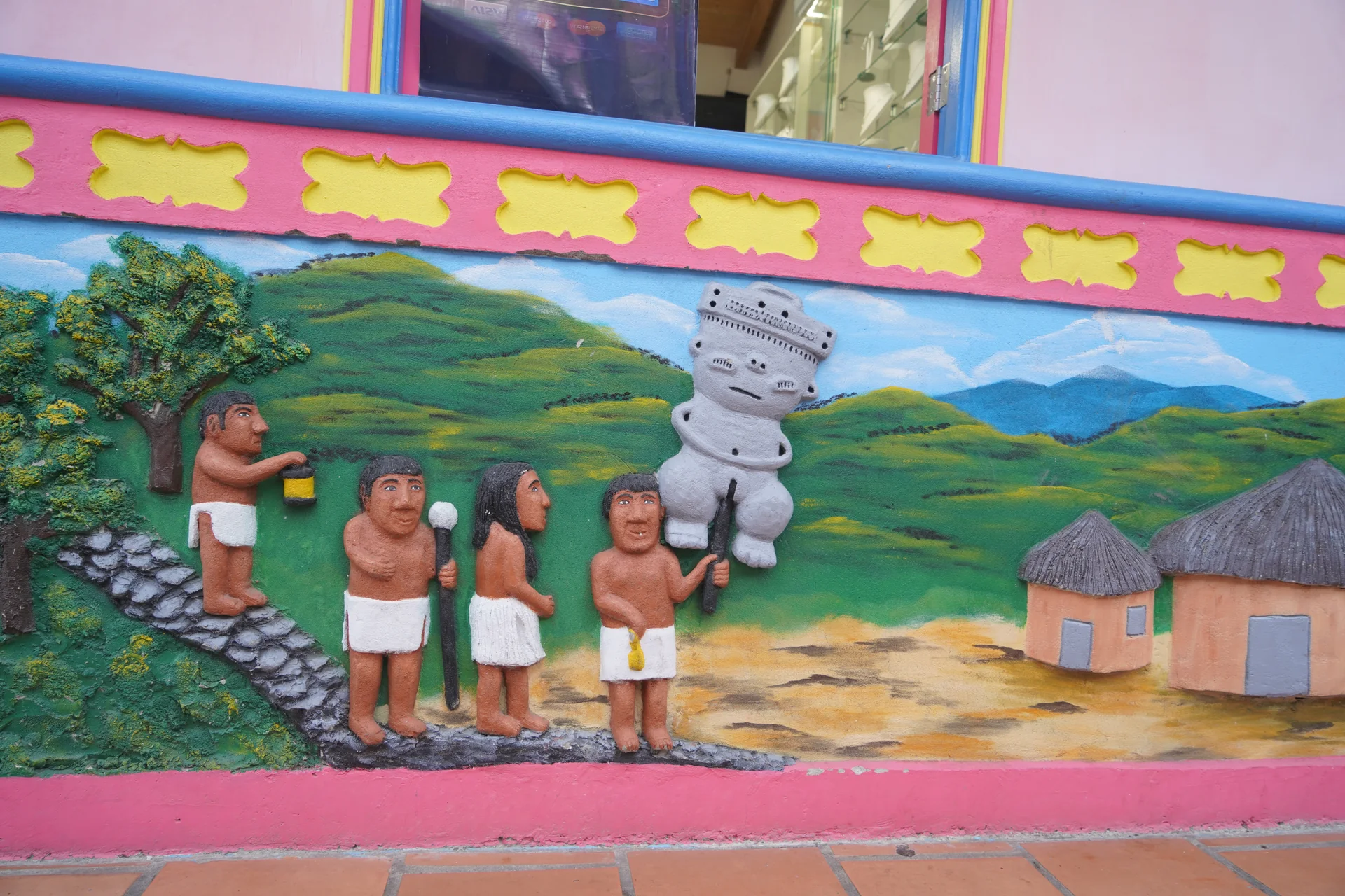
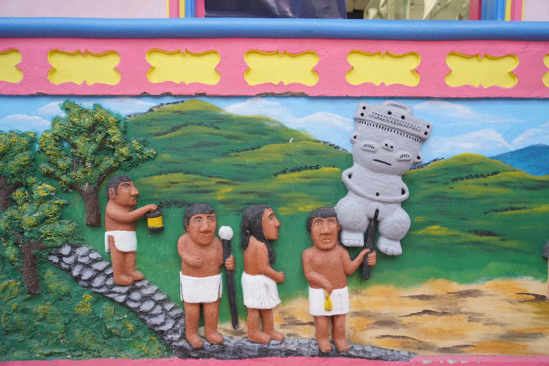
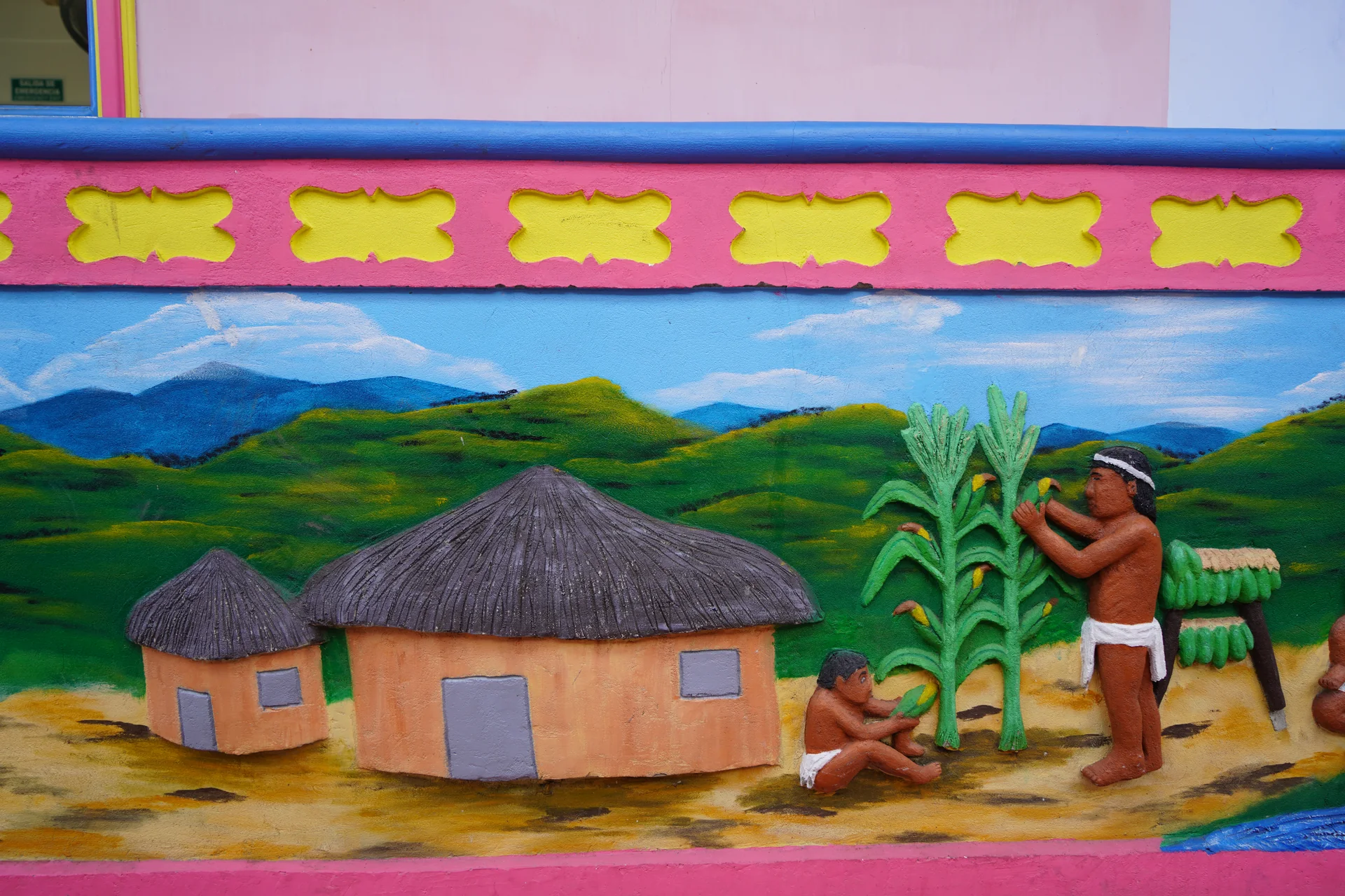
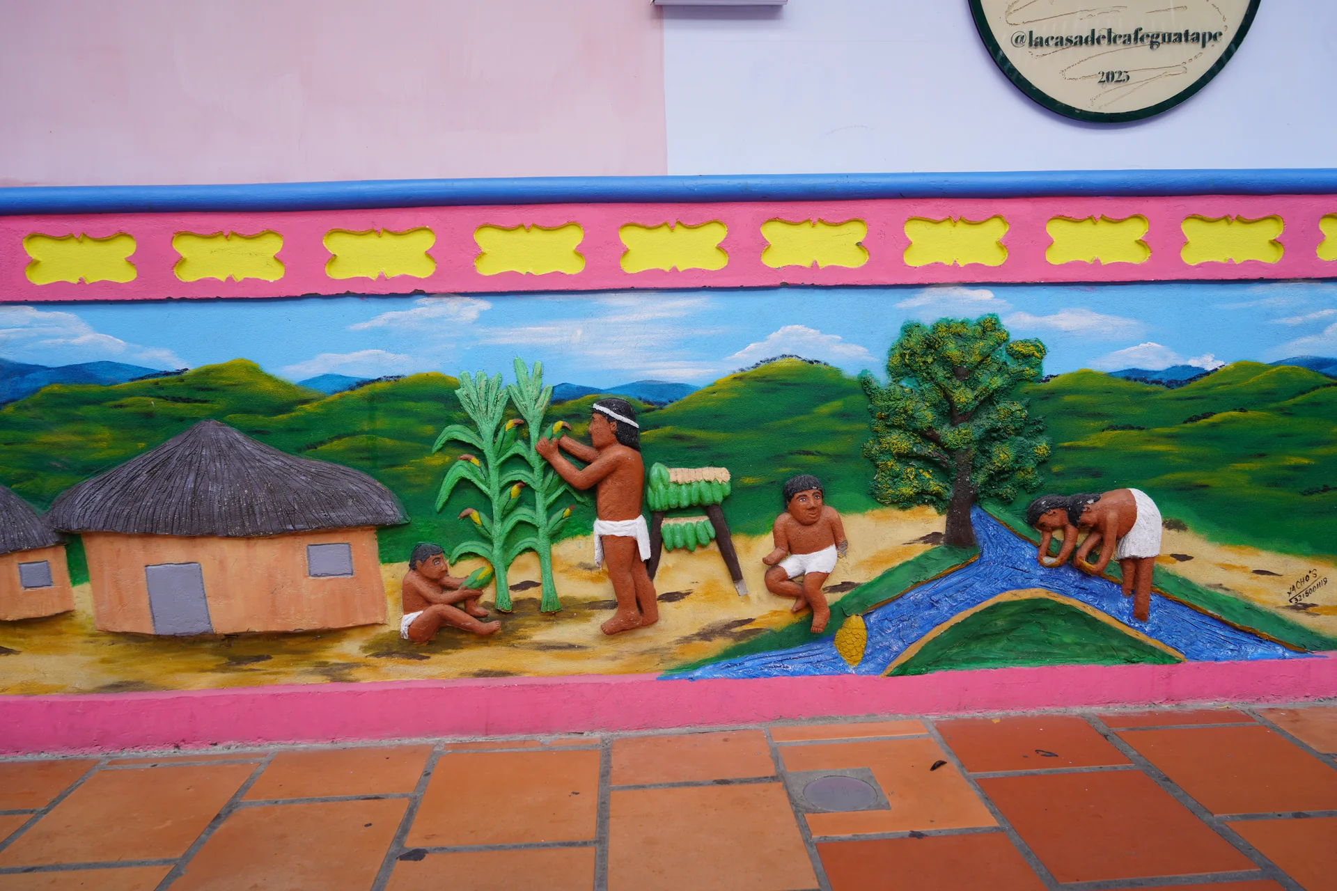
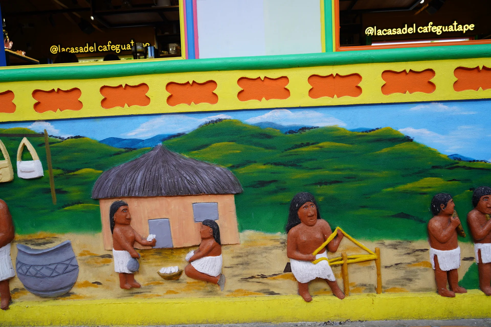
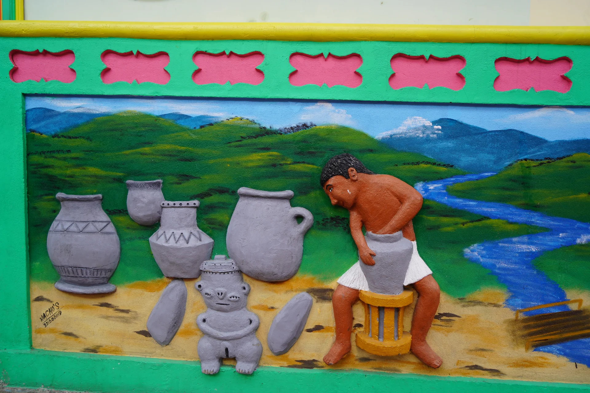
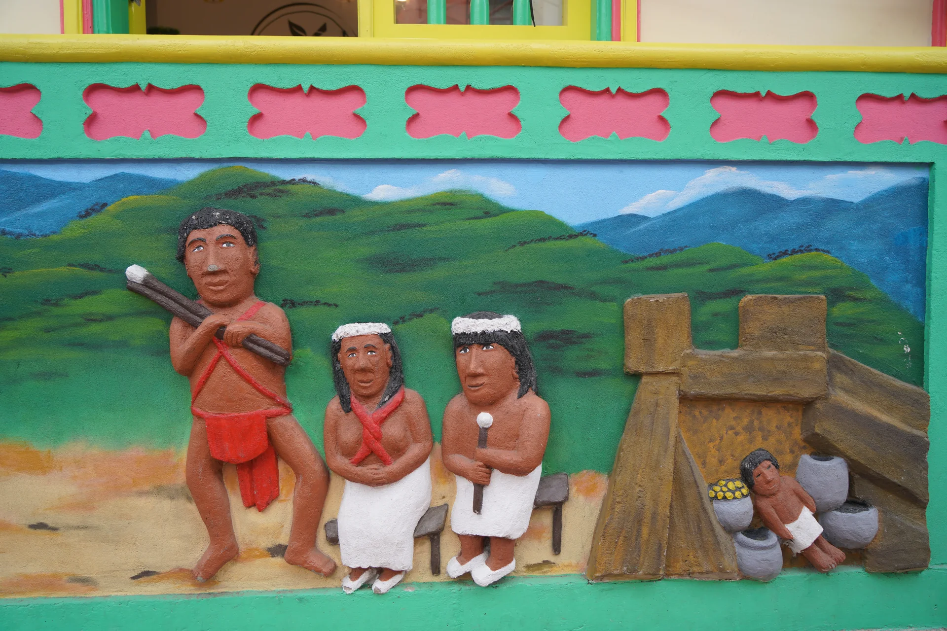
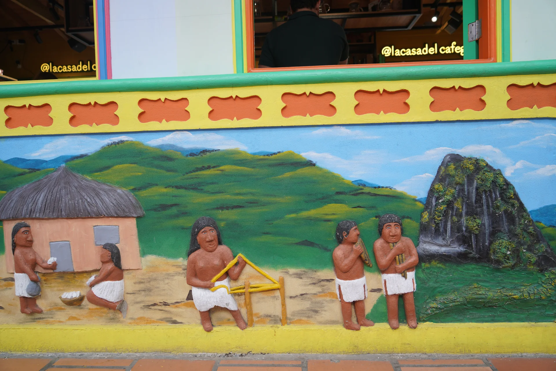
The zócalos — those painted relief panels on every building — are a form of cultural assertion too. A community that has been displaced twice, that has had its name taken and repurposed, covering its walls with images of who it is and where it comes from.
Zócalo Art
Tahamí Life in Stone and Color
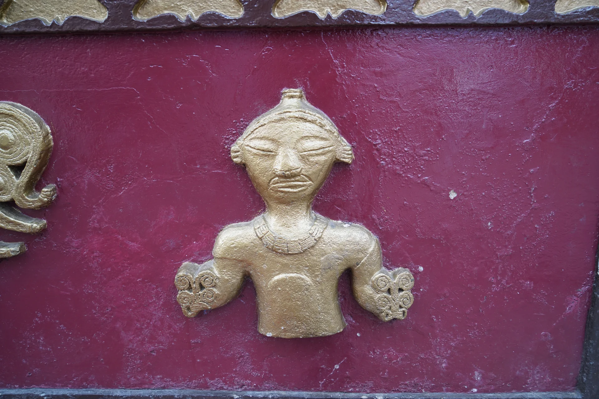
The zócalo panels preserve Tahamí culture in 3D relief — farming, ceremony, warriors and daily life sculpted into the walls of Guatapé.
Explore More